Monday, May 30, 2016

Edge of the World


Heading West out to Sea
When I look at the horizon with no land in sight, I always think of the oil paintings from the 1700’s depicting sailing ships falling off the edge of the world.  Indeed, we would not see land until reaching Haida Gwaii located 100 miles from Caamano  Sound due west from the coast of British Columbia.  
Mountains on Campania Island
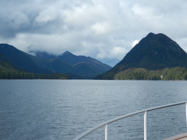
As we left the cloudy skies in Surf Inlet, we were met with sun and blue sky in Caamano Sound and headed due west around 5pm.  
Impressive Mountains on Campania Island
The sun shone on the mountains of Campania Island as we looked back at terra-firma passing over the Aranzazu Banks.  The evening was pleasant with a slight breeze and a 1 foot gentle ocean swell, but the crossing would be a long 16 hours of motoring.  
Heading West, Preparing for Nightfall
We prepared for nightfall laying out portable flashlights, life jackets, and diming lights on the instrument panel.  When darkness finally arrived around 10:30pm, we turned on the spotlight attached to the bow of the boat to watch for debris.  Peering through the darkness at a greenish haze just in front of the bow takes some getting used to.  You can’t really see the water, but objects in the water such as birds, kelp, and wood debris, reflect back the light.  Fortunately, we didn’t find any logs but did see a few chunks of wood.  The experience can also be a lonely feeling with no other boats in sight, we did however see a cruise ship on radar heading south, probably from Ketchikan.  
Skidegate Inlet and Double Mountain
The hours wore on and we took shifts at the helm, keeping a watch on the radar, navigation tracking system, and for any foreign objects in the water.  It can make one weary and even Java found the whole ordeal tiresome.  At last we spied the land of the Haida around 6am as we passed over the shallows of Laskeek Bank which extends out along the eastern shore.  
Double Mountain, Haida Gwaii
As we motored through the marked channel into Skidegate Inlet the mountains came into view.  Some of these mountains were shrouded in clouds while Double Mountain was bathed in sunlight adding to the wonder and mystic of Haida Gwaii.  
Sandspit Harbour Marina
There are two marinas to choose from and a couple of anchorages in Skidegate Inlet, we chose not to anchor due to the predicted winds and instead found moorage at Sandspit Harbour marina at 9am.  We were ready for a long nap after motoring continuously for 26 hours from Klemtu to Haida Gwaii, 187 nautical miles. 

Sunday, May 29, 2016

New Territory


Leaving our anchorage near Klemtu at 8am we continued up Klemtu Passage; once again, Dall's Porpoise came to escort us on our way.  We soon rounded Swindle Island separated from Princess Royal Island by a very narrow channel called Meyers Passage.  
Dall's Porpoise
This narrow, rock strewn waterway was a first-time traverse for us.  
Approaching Meyers Passage
A red buoy marks a rock that should be kept to port when heading south but there is also a rock lying on the starboard side of the passage, requiring careful transit.  
Meyers Passage
We slowly made our way through this pretty passage which
turns west and out to Laredo Sound, offering more new territory for exploration.  Turning northward we followed Laredo Channel avoiding the rocky reef situated in the middle of the channel, reaching
Caamano Sound
Caamano Sound exposed to the open ocean with beautiful vistas.  Our planned stop for the evening was an anchorage in Surf Inlet that cuts northeast into Princess Royal Island.  Before anchoring we wanted to see the falls and dam located at the terminus of the Inlet which is mentioned in the Waggoner Cruising Guide.  
Imposing Mountains in Surf Inlet
Even though it was overcast and cloudy, the mountains along this 13-mile fjord were inspiring.  The abandoned dam and powerhouse is over a 100 years old and was built to power mining equipment for a gold mine, known as Belmont, located above the dam at Bear Lake.  
Dam and Falls at end of Surf Inlet
The mine operated from 1918 until 1926, producing eight-million dollars’ worth of gold ore. 
After a visit to the dam, we motored back down Surf Inlet with plans to use Penn Harbour anchorage for the night and head to Haida Gwaii the following morning. 

Ruins of Powerhouse, Surf Inlet
As we listened to the latest weather
report (via our satellite-based InReach tracking and messaging device) predicting winds building over the next four days, we realized this would mean putting off the journey for another week.  Seas would be calm that night so we decided to go for it; we told ourselves we’ve done night crossings before and this was our window of opportunity to reach Haida Gwaii.  At 5pm we pointed the nose of Got d' Fever westward through Caamano Sound and headed out to sea.

Saturday, May 28, 2016

Shearwater to Klemtu


Departing Shearwater
After our late morning latte’s, we departed Shearwater heading northwest into Seaforth Channel, stopping for about 20 minutes in a small cove to re-calibrate the compass.  
Robb Point Lighthouse
As you go northward the magnetic deviation changes so it is wise to adjust the compass before making a long journey out to sea.  The process for recalibration involves several steps shown in the compass manual, after resetting the compass display and receiving the “turn boat” message, we maneuvered the boat very slowly making two circles until the display said “heading.”  We chose a heading and continued motoring until we could compare the ship’s compass with the auto pilot’s electronic compass, selecting the buttons for plus or minus as needed. 
Dall's Porpoise
Continuing west on Seaforth Channel, we passed the beautiful Robb Point Lighthouse on Ivory Island at the edge of Milbanke Sound encountering 13 knot winds.  Turning northward into Finlayson Channel put us behind Price Island where we had calm seas and the company of several Dall’s Porpoise who came to play alongside our bow.  
Approaching Klemtu Passage
Later that evening around
5pm we took the small Klemtu Passage off of Finlayson Channel and tucked into our anchorage in Clothes Bay for the night.  
Night's Anchorage in Clothes Bay, Klemtu Passage
The Native village of Klemtu on Swindle Island is home to the Kitasoo tribe of Tsimshians and is accessible only by air or water. 
Homes above Klemtu
 

Klemtu Fish Processing Plant
A ferry terminal was constructed in 2011 which now benefits the Klemtu Fish Processing Plant as well as the community in providing reliable transportation for coastal residents and helping to establish tourism.  
Longhouse at Klemtu
Klemtu is part of the Great Bear Rainforest and visitors can now request tours of the area from “Spirit Bear Adventures.”


Longhouse scenic setting at Klemtu


Seeking the Inside


Pine Island, Queen Charlotte Strait
Pine Island Lighthouse
We departed Nigei Island at 5:50am hoping the seas were settled from the earlier winds for an acceptable crossing of Queen Charlotte Strait.  Even after several day’s wait, we encountered 5 foot swells with occasional 6 footer’s at 6-8 second intervals.  With little to no wind, the journey was manageable.  We soon passed Pine Island Lighthouse, a manned lighthouse providing weather observations important to mariners in addition to readings from the West Sea Otter Buoy located northwest of Cape Caution.  After passing Pine Island, the period between swells widened to 10 seconds, but turning due north for Cape Caution put us broadside to the swell necessitating the need to tack (a zig zag maneuver) a couple of times for a more comfortable ride.  
Curious Sea Otter
As we neared Egg Island just north of Cape Caution, the seas became more settled with 4 foot swells.  A group of Sea Otters welcomed our arrival, and one curious guy popped back up to take another peek at us as we passed by.  Around 11am we entered Fitz Hugh Sound, the beginning of the “Inside Passage” of protected waters in Central and Northern B.C. which continues through Southeast Alaska.  A left turn into Lama Passage and the Hours Meter turned to 4,000 hours, a birthday of sorts for Got d’ Fever.  
Our Passenger The Raven
Rounding Denny Island, we arrived at 5:30pm in Shearwater, having picked up a passenger, a Raven who rode on the bow-rail for the longest time.  I always see Ravens near Native villages, maybe there really is a connection to those myths and legends.  After finishing dinner and before the engines cooled, Leonard changed the oil (3 gallons per engine), a routine job after every 200 hours of motoring, best done while the engines are warm.  The following morning we enjoyed a latte at the new coffee bar inside the gift shop at Shearwater.  
The Village of Shearwater
Shearwater is like an oasis for the central coast of British Columbia and serves the needs of mariners traveling the Inside Passage.  The gift shop now has a new owner, who has added a coffee/bakery bar which opened in May; we are happy to report that the lattes are excellent and the in-house bakery items are tasty.  Conversation in the shop soon turned to the area’s history. 
Enjoying Latte's and Muffins
The shop keeper’s mother used to work at the original hotel located at that time across the bay which eventually burned down, she no doubt has many stories to share at age 81.  Other stories from the past are too painful to share; of Dutch descent, she was a prisoner of war at the age of 9 in Indonesia.  As with many painful stories from WWII, they will be lost to time.  Shearwater also has a connection with WWII, having served as a base for 1,000 men of the RCAF flying patrols along British Columbia's central coast.       

Thursday, May 26, 2016

Just Around the Corner


Putteney Lighthouse on Malcolm Island
Before departing Port McNeill we topped off the fuel tanks and water tank.  Leonard also had his scuba-diving tank filled in the event he needs to check the underside of the boat; we wouldn’t want him sucking on an empty air tank!  The intended plan was to position ourselves at an anchorage for the night and leave early in the morning to cross the Strait and round Cape Caution.  From Port McNeill we usually head straight across Queen Charlotte Strait and anchor in Blunden Harbour on mainland B.C. before rounding the Cape.  Since the winds had been blowing for the last few days, we took a new route heading west, northwest passing Putteney Lighthouse on Malcom Island and continued west along the north shoreline of Vancouver Island in 2-4 foot chop.  
Chain of Islands along Goletas Channel
After passing Port Hardy, we entered Goletas Channel formed by a string of small islands.  Our chosen stop for the night was Nigei Island at an anchorage called Port Alexander.  Before reaching the anchorage, we decided to poke our nose farther into Queen Charlotte Strait to check out the sea conditions.  
Scarlett Lighthouse on Balaklava Island
Making a turn northward between Hurst Island and Balaklava Island, we passed the attractive Scarlett Lighthouse where the seas started to build into 5 foot swells, confirming that we should stick with our plan to overnight among the islands. 
Dall's Porpoise
It was about this time that a group of Dall’s Porpoise came to ride alongside our bow, zipping through the water like bullets.  We continued around Scarlett Lighthouse and headed south between Balaklava and Nigei Island, arriving at our anchorage at 1pm. 
Port Alexander anchorage on Nigei Island 
After a late lunch, we headed out with the dinghy to explore Nigei Island.  Huge pieces of driftwood, more accurately drift logs, lined the beach and we found that the forest was carpeted in thick moss.  Although no trails were evident on the island, the trees were nicely spaced without the interference of thick underbrush; we decided to hike across the island to the un-named bay on the other side.  We had brought a backpack with water, a flashlight, the portable VHF radio, and our Delorme tracking device as a precaution.  


Cabins on floats at Nigei Island
The hike across the island was about one-third of a mile and we found fresh cuttings in the forest as if someone had been chopping wood for a stockpile.  Upon reaching the small bay, we determined it would serve as a good anchorage spot for protection from south winds.  As we looked across the bay, too our surprise we saw a group of cabins on floats, perhaps living quarters for loggers or fishermen, or just people who want to live in a remote location!  
Ruins of a Boat Keel
As we turned to head back, we found the remains of a boat keel lying in the woods near the shore, how long had it been there? And what story might it tell?  Such is the intrigue of discovery.  
Port Alexander anchorage, Nigei Island
   

Wednesday, May 25, 2016

Healing the Past


Welcome to Alert Bay
 
Alert Bay on Cormorant Island is easily accessed by ferry from Port McNeill and is well known for the ceremonial wooden masks and other dance regalia on display at the U’mista Cultural Centre, dedicated to preserving the heritage of the Kwakwaka’wakw culture.  In 1921 the Government of Canada confiscated many of these items in an effort to stop the potlatch custom.  
U'mista Cultural Centre
Negotiations during the 1970’s and 80’s resulted in regaining many of these possessions which are now housed in two Native museums, one of which is the U’mista Centre at Alert Bay. 
Potlatch Regalia
Equally interesting are the photographs of Native school children along with their written remembrances and experiences while attending the early local school.  
Photos and Testimonials
St. Michael’s Residential School once stood behind the current day U’mista Cultural Centre; two-hundred children lived here during the 1920’s and 30’s.  Students were prohibited from speaking their own language and kept away from their families for years.  
Historic Photo, St Michael's School
There were accounts of physical, emotional, and sexual abuse that no doubt took place elsewhere but not disclosed or discussed in our history books.  St. Michael’s School was mostly self-sufficient with a dairy and extensive gardens often maintained by student labor.  Recently in February of 2015, the then crumbling red-brick school house was demolished.  Over 700 people stood on the site and “participated in emotional healing ceremonies as the building was taken apart piece by piece.”  The school had held classes from 1929-1974.  
Village of Alert Bay
The town of Alert Bay began in 1870 when two businessmen leased Cormorant Island from the government to establish a salmon saltery on the waterfront.  In need of labor, they convinced the Namgis (Kwakwaka’wakw) to relocate their village to the island, which had been used as a seasonal home and sacred resting place.  A cannery was established a decade later along with a store, sawmill, and post office.  The cannery closed during the Great Depression but the economy rebounded after WWII. The village of Alert Bay was incorporated in 1946 when the fishing and logging industries were booming.  Today, Alert Bay is a quiet town best known for its Cultural Centre.  In the months of July and August, visitors can attend Native dance performances at the Longhouse located north of the Culture Centre.  Above the main part of town is an Ecological Park which we visited for the first time. 
Ecological Park Boardwalk
The park is definitely worth a visit with a network of forest trails and a boardwalk through marshland with old snags frequented by Eagles and other birds.

Eagle atop a Snag

Tuesday, May 24, 2016

Early Days of Pulp & Lumber Mills

 
Port McNeill Area Map
After a beautiful sunrise at Port Neville we left our anchorage at 7am for the five-hour cruise to Port McNeill.  Once again the weather was pleasant with calm seas which is not necessarily the norm for Johnston Strait.  The winds began to blow that evening however, requiring a layover until seas subside.  In the meantime, we are making use of the marina’s courtesy van to enjoy some land-based day trips. 


Neroutsos Inlet at Port Alice
This morning we drove to Port Alice located southwest of Port McNeill on Neroutsos Inlet.  Port Alice is accessed by boat from the west side of Vancouver Island via Quatsino Sound.  In years past, we have cruised the west side of Vancouver Island and have gone into all five of the sounds that indent the coast line and some of their inlets leading many miles across Vancouver Island.  We are always amazed how far these inlets cut into the Island.  In this case, Port Alice is only 30 miles from Port McNeill by land. 
Neucel Pulp Mill, Port Alice
Port Alice is the site of a pulp mill at the head of Neroutsos Inlet that was constructed in 1916 and became operational in 1918.  Pulp mills convert wood chips or other plant fiber (cellulose) into thick fiber board which can then be shipped to a paper mill for further processing.  Cellulose fibers are used in textiles, paper, and diapers among other products.  The town first began with a row of houses and several bunkhouses placed a few hundred yards from the mill.  The original community was a company town that boasted a movie theatre, bowling alley, and golf course; later adding a hospital, bank, library, and school.  During the 1960’s some residents wanted to own their own homes and the company needed room to expand and modernize the mill.  
Neucel Pulp Mill, Port Alice
In 1965 a new community developed four miles to the north at present day Rumble Beach, now called Port Alice.  All that remains of the old town is the mill itself and the adjacent golf course.  We met one of the friendly locals in town who told us she and her husband had moved from the prairies to Port Alice over 20 years ago and that her husband had worked in the mill.  With disappointment in her voice, she said the mill had closed just two years ago and that many of the folks have started to leave town in search of other places to live.  
Moorage Docks at Port Alice
Who knows, perhaps Port Alice will one day become a ghost town as has happened to other mill towns of the 60’s era in northern British Columbia’s remote areas.  We drove back to the boat for lunch at Port McNeill and then left again in the afternoon to visit Telegraph Cove, located 15 miles east.  
Telegraph Cove
Telegraph Cove served as a telegraph station (built in 1911) as the northern terminus of the Campbell River telegraph line, sending and receiving Morse code signals.  Area pioneer Marmaduke (Duke) Wastell established a saw mill in 1922 and a chum salmon saltery first begun by Charlie Nakamura.  
Boardwalk, Telegraph Cove
Duke’s brother-in-law, Jim Sharpe, left a flourishing boat shop and marine ways in nearby Alert Bay to become the millwright at Telegraph Cove.  Jim made wooden pulleys, friction drives, and two-wheeled lumber carts seen on the boardwalk today.  Later, Duke’s son Fred Wastell and partner Alex Macdonald expanded and carried on the business of the lumber mill.  
Homes and Buildings on pilings at Telegraph Cove
The mill provided lumber for many of the buildings constructed throughout the northern end of Vancouver Island and operated for more than 50 years.  During WWII, the military commandeered the mill and used whatever the mill could cut; finding able-bodied men to do the work was a challenge since most men had been sent off to war and the Japanese workers and families were evicted by the Canadian Government.  To meet the need, sixty-five airmen were sent to staff and operate the mill.  In early 1946, the mill was returned to Fred Wastell and his partner Alex Macdonald.  Many of the original mill worker’s homes remain on the boardwalk surrounding the cove and are now quaint accommodations along with a pub and a couple of cafĂ©’s.  
Skeleton of a Juvenile Fin Whale
Telegraph Cove serves as a charming resort offering fishing tours, bear watching tours, whale watching, and kayak tours.  Telegraph Cove is also home to an excellent Whale Interpretive Centre, providing fascinating displays and educational programs.