Wednesday, June 29, 2016

Goddard Hot Springs


Dorothy Narrows
A new day and our next planned stop was Goddard Hot Springs on Baranof Island located behind Eovoli Island, just an hour’s motor away from Herring Bay through the inside passage of Dorothy Narrows.  We studied the charts and description regarding transiting Dorothy Narrows, a passage lined with submerged rocks requiring careful navigation.  
Local Fisherman (east of the channel marker)
The description was not completely clear as to which side of the green channel marker we should pass, the marker being in the middle of the Narrows.  We both concluded that reference was made to favor the east side of the marker.  We slowly motored into Dorothy Narrows along the east shore and saw a fishing boat coming from the opposite direction.  He too was keeping to the east side of the channel marker confirming that we had chosen the correct side; when in doubt, watch the local traffic or ask a local boater.  
Goddard Hot Springs, Hot Springs Bay
Once through the Narrows we motored into Hot Springs Bay and anchored in front of the Hot Springs on Baranof Island.  A lovely spot but the anchorage can be questionable so we took turns going ashore.  
Boardwalk along shore to Tub
A boardwalk marks the way to the tubs, one tub is located along the shore and the other tub up the hill.  
Boardwalk to upper Tub
Both tubs are enclosed by a wooden shelter and are maintained by the U.S. Forest Service.  You can even regulate the temperature from warm to hot by using two valves that supply spring water stored in tanks.  An outflow pipe in the tub helps keep the water clean.  
Hot Springs Tub
We noticed that there were names etched or penned on the sides of the walls around the tubs, of course we had to add our boat name for posterity sake.  
View from Hot Springs Tub
The best part about visiting here is the beautiful view from the tubs overlooking the sea; and for many, a long relaxing soak can improve the skin and relax the soul.  After spending most of the afternoon at the Hot Springs, we continued north passing Povorotni Point and Cape Burunof.  
Artwork inside Hot Springs Tub Shelter
The name Burunof comes from the Russian mys burunof (cape of breakers).  We chose Samsing Cove on Baranof Island as our anchorage for the next couple of nights, conveniently located just four miles from Sitka.  
Boat Name for posterity sake


Afternoon Sun at Hot Springs Bay

Tuesday, June 28, 2016

A Splendid Coast


Beautiful Mountain Scenery, Baranof Island's west coast
 
Departing Sandy Bay we continued north along the beautiful coast of Baranof Island, new territory for us to explore.  
Rugged Coastline, Baranof Island
This splendid rocky rugged coast is backed by snowcapped mountains that glisten in the sunlight beckoning us shoreward.  
Entering Still Harbor
We entered Still Harbor for an early lunch and short respite, aptly named for its protected, calm harbor.  A frightful and interesting story took pace here in 1999.  Don Douglass tells the story in his Southeast Alaska cruising guidebook.  A man by the name of Ward Eldridge spent six years rebuilding a 73-foot schooner he found in a Florida boatyard and brought her through the Panama Canal and up the West Coast to Sitka.  
Still Harbor, Baranof Island
Ward and his new wife to be, Kathy, set out for a weekend and anchored in Still Harbor.  They launched their kayaks to do some exploring and when they came back several hours later, the masts were the only visible part of their boat, the rest was under water.  Ward wondered if a seacock had failed and Kathy wondered if there had been an explosion.  They were able to get a ride back to Sitka on another boat where the community offered their help and financial support.  Ward later speculated that a whale might have rammed his boat, the Merlin, but others were doubtful.  In a big community effort, his vessel was raised and towed to Sitka.  A piece of baleen, 4x16 inches, was found wedged in the hull near the hole in his boat.  Merlin was later re-planked and donated to the Sitka Maritime Heritage Society.  
Departing Still Harbor, Baranof Island
We didn’t find any whales in Still Harbor but we did see a whale as we approached the entrance and again as we departed; neither whale attacked Got d’ Fever.  By early afternoon we passed North Cape and an hour later, Aspid Cape.  Seas throughout the day were consistent at 3-4 feet with little to no wind, a nice fair weather window to cruise the west coast of Baranof Island.  
Cameron Pass
Later in the afternoon we headed toward the rocky shore once again, this time motoring up Cameron Pass along the southeast side of Beauchamp Island.  
Crawfish Inlet
From here we explored Crawfish Inlet and West Crawfish Inlet connected by two narrow passage ways, Second Narrows and First Narrows which required careful navigation between rocks and shoals. 
West Crawfish Inlet
After visiting Shamrock Bay in West Crawfish Inlet, we navigated through Windy Passage back towards the sea 
Herring Bay
and anchored for the night in Herring Bay on Elovoi Island.


Monday, June 27, 2016

The West Side


Cape Decision, Kuiu Island
 
We departed Louise Cove on Kuiu Island and continued south down Sumner Strait which was glassy smooth with 1 foot swells.  At the ocean entrance to Sumner Strait, we turned west towards Cape Decision on the southwest tip of Kuiu Island.  When we reached Cape Decision the seas were still calm with a gentle 2 foot swell so we made the “decision” to continue west rather than turn north up Chatham Strait along the east side of Baranof Island.  We would instead cross over Chatham Strait and then turn north along the outside or west side of Baranof Island.  As Douglass states in his boater’s guidebook, “Exploring Southeast Alaska,” very few pleasure craft venture along Baranof Island’s west coast because of its remoteness and direct exposure to the Gulf of Alaska and should be attempted only in fair weather.  As we crossed Chatham Strait, we encountered 3 foot swells with occasional 4 footers but at intervals that were still comfortable.  
Humpback Whale, Cape Ommaney
The next challenge would be to round Cape Ommaney on the southern tip of Baranof Island before turning north into the waters of the Gulf of Alaska.  As we approached Cape Ommaney, the swell began to build to 6 feet but still at acceptable intervals due to the fact that there was no wind.  We found the scenery to be magnificent along the west side with towering mountains as if trying to hold back the sea.  
Humpback Whale, Cape Ommaney
Humpback whales were spotted off the Cape, adding to the intrigue and beauty of this incredible place.  We rounded Cape Ommaney about 1pm and noticed that we were going against a 1 knot current which lasted for about an hour.  
Cape Ommaney
We surmised that the large volume of water flowing in and out of Chatham Strait must be wrapping around the Cape and causing some stirred seas.  Continuing northwest along Baranof Island the sea state returned to a more characteristic ocean pattern and swell.  
Cape Ommaney
The mountains along Baranof’s west side are striking, some still dusted with snow.  
Mountains along Baranof Island
Several enormous waterfalls could be seen tumbling down the mountain faces – what appeared to the naked eye as snow patches or slides were clearly seen as huge waterfalls through the binoculars.  
Mountains along Baranof Island
At 4pm we had arrived at our chosen anchorage, Sandy Bay.  
Approaching Sandy Bay
We made our way through the surf coming into shore and entered the protected bay. 
Entering Sandy Bay, Baranof Island
The entrance is surrounded by a rocky shoreline typical along this coastline.  
Sandy Bay, Baranof Island (waterfall at head of the bay)
Once inside the bay, the shoreline reveals forests and meadows backed by mountains. 
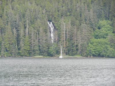
Waterfall at Sandy Bay
A waterfall is located at one end of the bay where we found a sailboat anchored, a nice addition to the picturesque setting.  
River Excursion, Sandy Bay
After dinner we took the dinghy up a river inlet for a short excursion to enjoy this ocean side secluded wilderness.

 
Sandy Bay, Baranof Island

Sunday, June 26, 2016

Too Crowded?


Humpback Whale, Point Baker
After spending the night at Point Baker, we headed out the following morning and once again saw a number of humpback whales just off Point Baker.  
Port Protection
We carefully motored around the Point, the north end of Prince of Wales Island, into Port Protection to see this small community of 48 people, another fishing village begun in the early 1900’s by “Wooden Wheel” Johnson.  He began with a store and fuel dock which allowed trollers to stop for supplies and anchor in this large harbor.  
Port Protection
The port was named by Captain George Vancouver during his explorations.  Today Port Protection has a small number of commercial fishing boats and most services are seasonal.  
Port Protection
The town appears even more rustic than its neighbor, Point Baker; I guess the suburbs are always a little nicer.  
Mountains above Port Protection
From Port Protection we continued south along Sumner Strait stopping at the entrance to an anchorage called “Hole in the Wall.”


Hole in the Wall Anchorage, Sumner Strait
This nearly landlocked anchorage has a very narrow, shallow entrance which should only be accessed at half tide or higher.  Since we were just coming off of a low tide or zero tide, we could not safely enter the anchorage but did peer through the keyhole entrance, it looked very nice.  
Louise Cove on Kuiu Island off Sumner Strait
As the day wore on, three-foot swells started rolling up Sumner Strait and we decided to take anchorage in Louise Cove located on the east side of Kuiu Island.  Louise Cove provides good protection from most winds and looks pretty with its meadow like shoreline.  As we entered the Cove, we discovered an old abandoned cabin and took the dinghy ashore to explore the area.  Items still remain inside the cabin – remnants of an old wood-burning stove, a cup, and several buckets; wooden cup-boards line the walls and there are makeshift tables and a wooden platform for a bed.  I wondered who had lived here and why.  
Abandoned Cabin, Louise Cove
Perhaps a lone fisherman or someone who thought Point Roberts or Port Protection were becoming too crowded?!


Abandoned Cabin in Louise Cove

Saturday, June 25, 2016

Rustic, Tough Alaska


Got d' Fever at Point Baker
We said goodbye to all our friends at Thorne Bay and headed out in the morning around 9:20 for the day-long trip to Point Baker located at the northern tip of Prince of Wales Island.  
Fishing Boats at Point Baker
Winds were blowing at 20 knots with 4 foot seas as we traveled north in Clarence Strait but later subsided to 18 knot winds with 2 foot swell after we turned west along Sumner Strait, reaching Point Baker at 3:15pm.  If you are looking for that rustic, tiny fishing village portrayed in the movies with a tough style of living in Alaska, we found it at Point Baker. 
Got d' Fever along side the Saloon at Point Baker
The village is accessible only by boat or floatplane, there are no roads or vehicles here.  Point Baker has a year-round population of 15 people and we saw two of them in the bar while the others were out fishing.  The community was established in the early 1900’s as a fishing port for gillnetters and trollers.  During the summer months, sport fishermen arrive at the two lodges in the harbor to enjoy the excellent fishing and see the whales that are often present just off the Point; indeed, we saw numerous humpback whales just before entering the harbor.  
The Saloon at Point Baker
It’s all about the fishing at Point Baker, you won’t find any cute shops, a plaza, or any other source of entertainment here except card games and darts at the saloon along with food and drink.  There is no charge to tie-up at the village but space is limited so the custom is to raft together when needed.  
Eats at the Rustic but Cute Saloon, Point Baker 
We found space directly in front of the saloon and had a burger and drink before the saloon closed.  The "barkeep" was friendly and we were invited to add a personalized dollar bill to the "money wall."  You never know, we may be back and use that money later.  The saloon and café are open only during certain days of the week along with other basic necessities like laundry, showers, a convenience store, and fuel sales.  
Money Wall at the Saloon, Point Baker
The community has electrical power via a generator but the water should be boiled before consumption.  Most all the buildings are on floats including the Post Office established in 1941, a community hall, the saloon, café, restroom facilities, and a volunteer fire-department.  
Got d' Fever Money added to the Collection
My mind was having a hard time wrapping around the idea of living in such a remote location with only the basic necessities for existence, what? No shops! No roads! No entertainment except for a satellite dish TV in the saloon?  At least the fishing lodges have satellite-based internet connection. 
Sport Fishing Lodge, Point Baker
For residents of Point Baker, traveling by boat to Wrangell or Craig (40-50 nautical miles away) is like going to the “big city.”  
Community Hall and Post Office, Point Baker
Our “barkeep” said he hadn’t been to Ketchikan in 18 years!  
Flower Boxes at the Post Office, Point Baker
Wow, when Leonard suggested that we should stay here for a month, I started to develop a nervous twitch.